Reveal. Guide. Operate.
The Platform That Connects Your Entire Mountain Experience
Connect everything guests need to know, including parking, lifts, trails, dining, and amenities, into one interactive map that guides their entire day


Why resorts choose SlopePlanner
A Connected System
Connect trails, lifts, amenities, media, and conditions in a single platform. Replace fragmented maps, tools, and workarounds
Updates Stay in Sync
Change information once and it updates everywhere—maps, route plans, status pages, signage, and guest communications
Guided Experiences
Create curated routes, trail previews, and experiences that help guests navigate with confidence
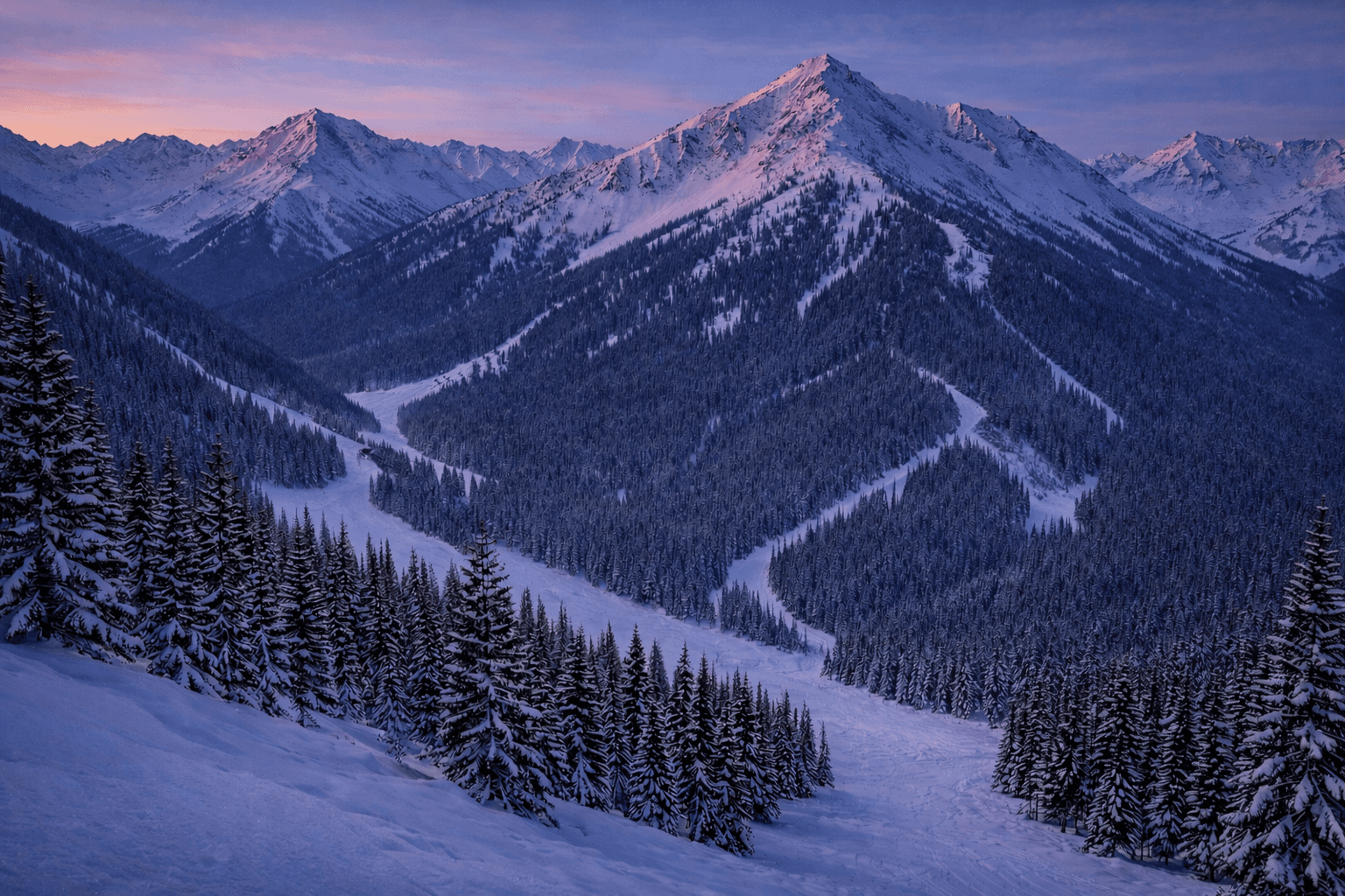
Your guests have evolved. Your trail map hasn't
Static Maps Don't Guide: Most guests ski infrequently. Trail maps overwhelm instead of helping them decide
No Preview, No Confidence: Guests can’t see conditions, terrain, or what a run feels like before they drop in
The Mountain is Undersold: Trails, amenities, and experiences rarely get showcased in a meaningful way

Reveal the mountain.
Guide every guest.
Operate in sync.
Let guests preview terrain in 3D & video, follow routes that match their skill level and preferences, and get day-of opening alerts
Everything you need to Reveal, Guide, and Operate
Replace disconnected maps, media tools, and status systems with a single platform designed to work together
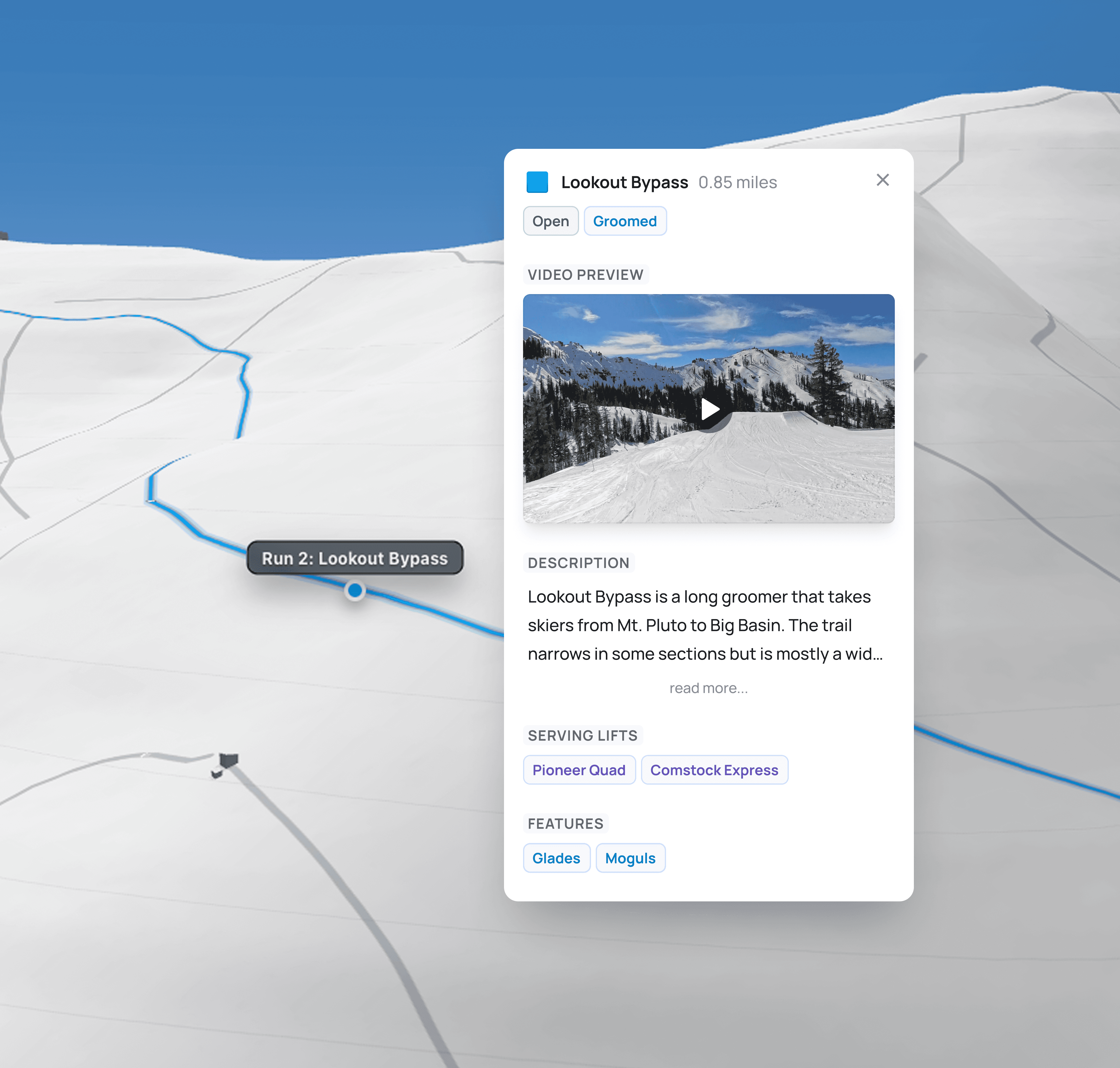
A Better Map Experience
Guests can zoom, rotate, and click into trails, lifts, and resort features to understand the mountain before they arrive
Videos of Every Trail and Lift
Bring the mountain to life with videos and images embedded directly on the map—letting guests explore trails, lifts, terrain parks, and amenities before they arrive

Route Plan Builder
Our industry-first route plan builder combines lifts, trails, and amenities into a run-by-run plan with embedded video previews

Turn Your Terrain Into a Content Engine
Create a collection of staff-curated route plans that help guests find their perfect day
Designed to Share
Share route plans and updates through simple links and QR codes—on mobile, signage, and screens
Integrated Status & Alerts
Manage lift, trail, and feature status. Updates automatically sync across maps, route plans, status page, and alerts


Launch Your Mountain Experience in Four Steps
We handle the heavy lifting so you launch a guest-ready digital experience fast

Build a Video Library for Every Trail & Lift
Use our full-service crew or your own cameras—we’ll turn raw videos into branded, map-pinned previews guests can trust

Full-Service Filming
Plan, film, and edit every trail & lift in 4K (360° optional)
Typical timeline: Small 1 day, medium 2 days, large 3–5 days
Deliverables: branded, edited clips plus raw masters
Bring Your Own Footage
You capture with your gear (or our kit); we edit and brand
We upload and pin each clip to the right trail/lift in Slope Planner
On-Brand by Design
Launch on your subdomain—your logo, voice, with live updates

On your subdomain
maps.yourresort.com with your logo, colors, and a header/footer that matches your site

Brand every clip
We deliver trail & lift videos with your graphics and music—ready for web, social, and lodge screens

Easy to promote
Link from site nav and email; drop QR codes on signs; loop it on digital signage
FAQs
Find answers to your most pressing questions about Slope Planner and its features